A Wild South Island Road Trip 2
The CatlinsA coastal treasure
Have you read the first half of my trip yet? Just click here to check it out and then come back once you’ve finished!
You’ll now head towards the east coast of the South Island, travelling through the lush hills of New Zealand’s southern farming district. Leaving Te Anau, I recommend taking a quick detour to Lake Manapouri, a picturesque spot and the gateway to Doubtful Sound. Break up the journey with a stop in the small rural town of Lumsden (which interestingly, used to known as The Elbow) before continuing on through Riversdale and Gore to arrive in The Catlins.
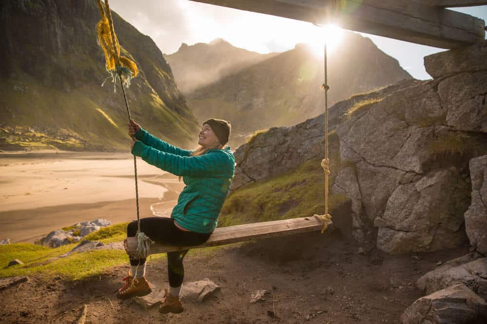
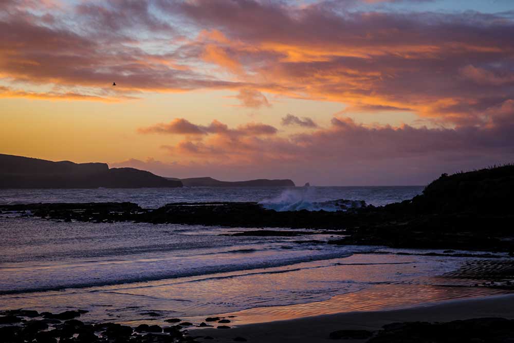
Often overlooked by travelers, The Catlins is a hidden treasure, and another one of my fave places to escape civilization (yes, I’m aware I have a lot of favorites. I’m allowed, ok!) Rugged and remote, it’s sparsely populated and home to vast empty beaches, wide grassy hills, native podocarp forest and abundant marine life. It’s also known for its isolation and unpredictable weather – but that’s all part of the charm, in my opinion!
Visit Curio Bay, globally renowned for the Petrified Forest that graces its shores. This 160 million year old historical wonder can be seen at low tide and is an absolute must-see while you are here. Curio is also home to a colony of Yellow Eyed Penguins and often dolphins can be spotted on the outskirts of the bay. If you’re an adventure enthusiast (and don’t mind the freezing water) Try your hand – or rather – your balance on a longboard at the local Surf school, something I’ve yet to try myself!
The Catlins is surrounded by bodies of water and one of the most spectacular is the Purakaunui Falls. Only a short stroll through pristine ancient beech and podocarp forest these falls are well photographed due to their unique three-tiered flow. You’ll first come to the upper platform (about ten minutes of easy walking) but continue on for another 5 minutes to reach the lower platform and the best views.
One for the history buffs is Nugget Point, where one of the country’s oldest lighthouses is located. Built in 1869 the Nugget Point lighthouse is still operational today and affords some of the best views in this area! From the car park a picturesque path leads you along the steep headland to the lighthouse and viewing platform where you’ll see the Islets or ‘nuggets’ and below, the resident seal colony can be seen basking on the rocks.If you can spare the time def head out to Slope Point as well – New Zealand’s Southernmost tip – where its steep cliffs mark the last piece of land separating NZ from Antarctica (except for a few uninhabitable islands along the way) Accessible only by foot, it’s around a 20 minute walk to through green meadows and (of course) sheep.
Finally, if you’re into the weird and wonderful make a stop at the Lost Gypsy Gallery. A random collection of automated gadgets made out of recycled materials and scrap metals all housed in a dilapidated bus. Equally strange and entertaining at the same time, this pit-stop is kiwi ingenuity at its best.
DunedinWhere Urban Meets Nature
The drive from the Catlins to Dunedin traverses the East Coast and takes just over an hour. This road forms part of the Southern Scenic route, and this particular leg first takes you through the rural town of Balclutha, then across the wetlands on the outskirts of Dunedin city.
Known as the Edinburgh of the South, Dunedin is rooted in Scottish history. One of the best preserved victorian cities in the Southern Hemisphere, it’s home to an eclectic mix of both historical and modern architecture. Surrounded by rugged coastal plains and wild windswept beaches – it’s renowned for the impeccably kept Flemish Baroque-inspired Railway Station, or as I like to call it – the Gingerbread House! Predominantly a University Town, recent years has seen rise to an explosion of culture not dissimilar to Melbourne or Wellington (which is probs why I like it so much).
The foodie scene is incredible here and I’ve only just recently discovered its delights for myself. Head to the Saturday farmers market held in the disused railway grounds for a taste of organic produce, local honey and handmade crepes and pastries. Wander down Vogel Street and pay a visit to the Vogel St Kitchen, my absolute fave foodie hangout. The coffee is out of this world good. Like really good. Another great place to eat is the Prohibition Smokehouse – which I can only describe as ‘gourmet’ South American barbecue. Amaze.
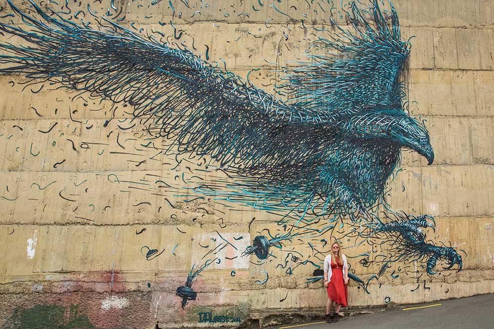
One the best surprises about Dunedin is the extraordinary street art. Personally, I’ve found the coolest cities around the world have a lively art scene, and usually have a good amount of murals and street art around town, and Dunedin is no exception. There are free maps that show you where some of the more prominent pieces are, but I definitelyrecommend taking a street art tour with Victoria of Street Kiwi – she is a local legend! Super passionate about street art, she started her own tours and has followed along as the street art scene exploded in Dunedin.
If I had to put a finger on why I love Dunedin, it’s because it’s a city that doesn’t feel like a city; it’s a place where civilization and nature co-exist in perfect harmony – something rather unusual these days. With wild beaches, epic wildlife, plenty of remote hills and coastal walks, Dunedin is a beautiful place to get outside and just ‘be.’
While there are great walks and beaches in the city itself, my favorite natural spaces are just along the Otago Peninsula, a little way out of town. A lovely winding road takes you along beautiful bays, through little blips of rural townships with one or two quirky spots in the middle. Oh, and great views! The Otago Peninsula is also home to the largest land based Albatross Colony in the world so while you’re out here be sure to visit the Royal Albatross Centre to see these spectacular birds.
While you’re in town, take a tour of the Cadbury Chocolate Factory and visit the Otago Museum for an interesting insight into local history. Or for a more immersive historical experience, follow the coast to New Zealand’s only castle, Larnach Castle. Built in 1871 it’s located on the Otago Peninsula and it’s just lovely. A stunning victorian castle slash manor house, it definitely transports you to another age. You can stay at the lodge on the grounds or just come and tour the house and gardens during the day.
Aoraki/Mt. CookAoraki - New Zealand’s Highest Mountain
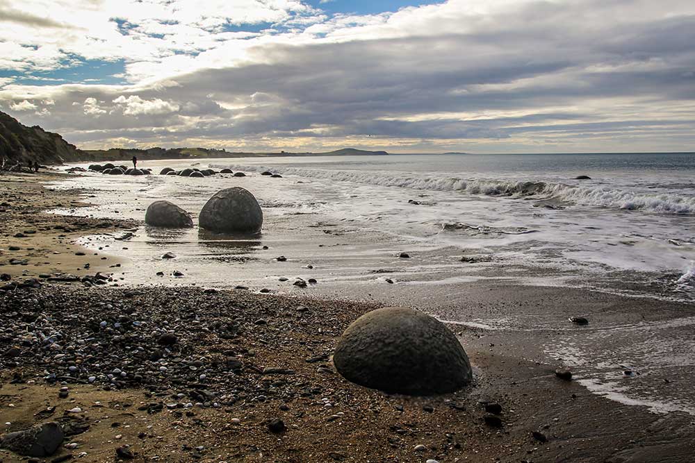
The drive from Dunedin to Aoraki/Mount Cook takes you back towards the heart of the country. It’s around 4 hours, but I would allow a full day for this trip as there’s a ton of things to see! Stop at the Moeraki Boulders, a group of large spherical ‘stones’ and geological phenomenon. Over 60 million years old, this strange attraction is remarkable and well worth a visit.
Also in Moeraki, stop in at Fleurs Place – renowned on the NZ foodie scene for its fresh seafood. From here it’s another hour or so to Oamaru where the cutest little blue penguin colony makes its home. Much of the buildings here are hewn from white Oamaru Stone adding an interesting uniformity to the overall town facade. Be sure to pop into Adventure Books downtown, which has a huge collection of beautifully curated travel and expedition books, and the biggest collection of books about Antarctica and the Polar regions in New Zealand.
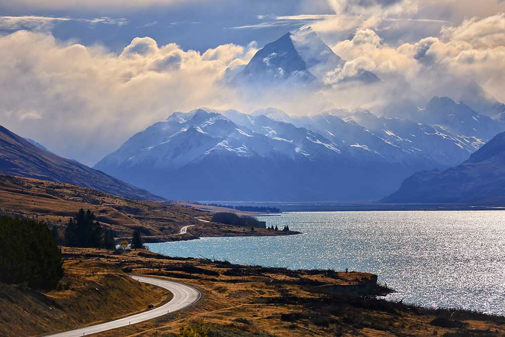
Turning in from the coast, you’ll head back inland through the Waitaki Valley, New Zealand’s newest wine region straddling the boundary between Canterbury and Central Otago. Arriving into Omarama the landscape becomes wide and open – and you’ll likely see many glider planes gracing the skies. World and national gliding records are regularly broken here, where the Mackenzie basin and the foothills of the Alps provide almost constant updrafts. From Omarama it’s only an hour to Aoraki/Mount Cook, past Lake Pukaki – an incredible glacial lake stained a brilliant turquoise color.
Mt. Cook is New Zealand’s highest peak and is a whopping 3,724 meters (12,218 ft) located in the center of the South Island in Canterbury, and trust me, she’s a beauty. With a bold, super iconic peak, there’s no mistaking Mt. Cook when you are within a hundred miles of it. It stands out above and beyond the surrounding Southern Alps. If there was one place in the South Island you asked me to drop everything I was doing and head over immediately, it’s Mt. Cook.
The road into the village definitely rivals the Milford Road as one of the most scenic in New Zealand. Although lonely and remote this dead-end highway is incredibly beautiful – I wish I could give you a time for how long it takes to drive from the top of the road where you turn off the main highway to the village, but I don’t think I have ever made it the whole way without stopping about 10 times for photos.
The village itself is tiny and doesn’t offer much apart from a few motels, the Hermitage Hotel, and the Sir Edmund Hillary Alpine Centre. I definitely recommend staying at the Hermitage, and if you can swing it, splurge on a premium plus room for achingly beautiful views of Mt Cook from your window. Most people come as a base to go play in the mountains.
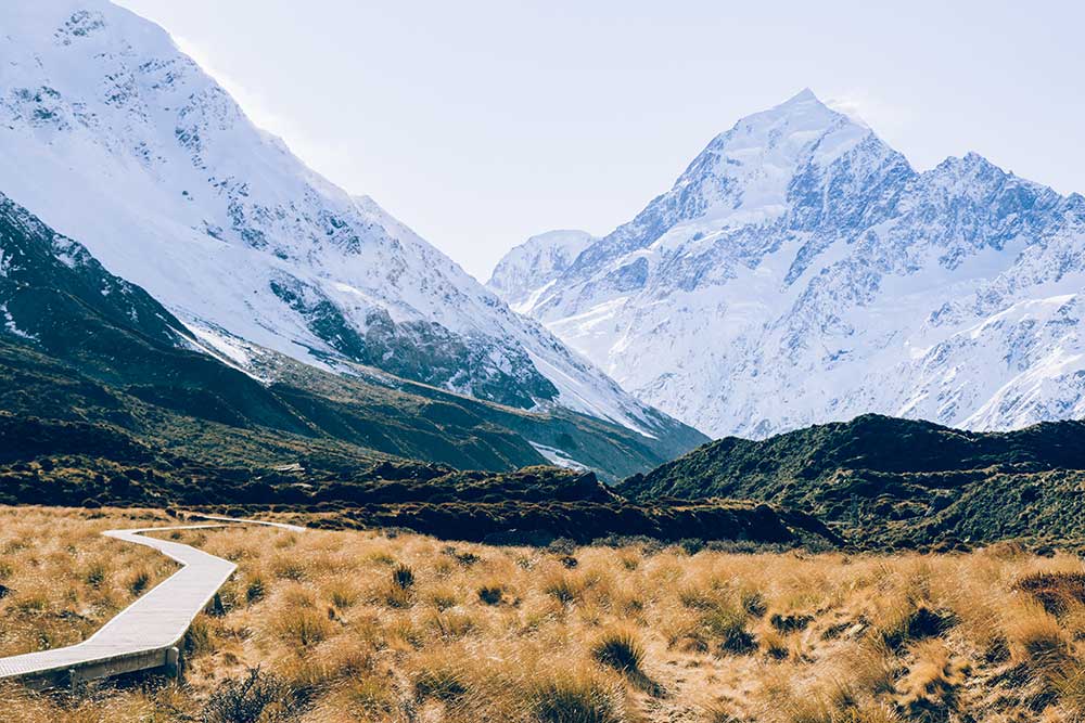
It goes without saying, Mt Cook is all about the scenery. A world heritage area, you could stay here for weeks and still not run out of things see or do. One of my faves is the the Hooker Valley walk, literally the easiest-walk-to-the-most-rewarding-view ratio in New Zealand. You could do this walk in your flip flops (or jandals if you want to have a crack at the local lingo) it’s such a nice, groomed trail and really mellow stroll down the Hooker Valley to a glacier lake at the bottom of Mt. Cook. More icebergs than you could ever want and a few fun swing bridges to bounce along. It’s around a 3-4 hour return but be sure to give yourself plenty of more time because you will probably stop for photos every 5 minutes. There is no ugly part of this walk.
I’d been to Mt. Cook so many times and never turned down the road to the Tasman Valley, having heard it wasn’t as dramatic as its counterpart – the Hooker Valley. Wow, was I wrong! The drive out to the start is beautiful, and the actual walk is more interesting than the Hooker Valley, thanks to a varied and challenging trail with a bit of climb. You’ll go past a couple of beautiful little greenish blue ponds on your way up which are worth stopping at, and in winter (if you’re lucky) they might be frozen over. The view at the top looking down at the Tasman glacier lake is just stunning and you can see the solid blue ice wall at the end of the glacier leading up to the back of Mt. Tasman and Mt. Cook. Usually there’s a handful of icebergs floating around as well.
Make some time to visit the Sir Edmund Hillary Alpine Centre while you’re here and you’ll gain a unique insight into the life and achievements of New Zealand’s very own mountaineering legend (the most notable being that he was the first person in the world to climb Mt Everest). The small museum has its own 3D theatre and digital dome planetarium showcasing 3D films, documentaries and shows throughout the day. If you’re looking to do an overnight hike and stay in one of New Zealand’s iconic red huts, go up to Mueller Hut at Mt. Cook. A steep and challenging climb, it’s worth all the pain once you’re there.
Mt. Cook is part of the Aoraki Mackenzie International Dark Sky Reserve, which is the biggest dark sky reserve in the world. Here is one of the best places to see the stars because there is almost no light pollution. As someone who grew up on the urban east coast of the US, I can tell you there are few things I appreciate now quite like the New Zealand sky. It is just spectacular, and I pinch myself every time I see the Milky Way. Make sure to stay away and go for a walk, camp or just sit outside and stare at the stars if you visit Mt. Cook. They’ll blow you away.
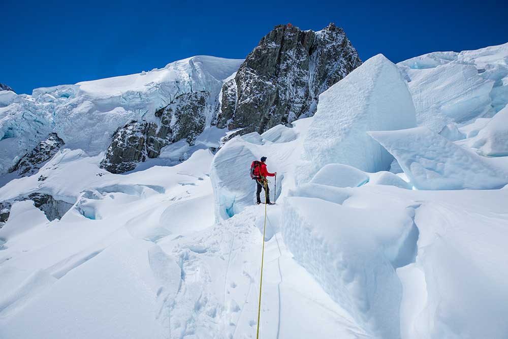
Another absolute, non-negotiable on this trip is a helicopter snow landing. Being able to see Mt. Cook from a chopper is one of the best ways to experience this part of New Zealand and really get a scope for how dramatic and wild the landscape is here. The Helicopter Line has heaps of different flight options for the Mt. Cook area. My favorite part is flying over the braided rivers that lead down to Lake Pukaki. In the late afternoon light they look like they are on fire! Head up with Mt. Cook Ski Planes and Mt. Cook Glacier Guiding to go snowshoeing or heli-hiking on the Tasman Glacier for a unique experience.
TekapoBluer Than Blue
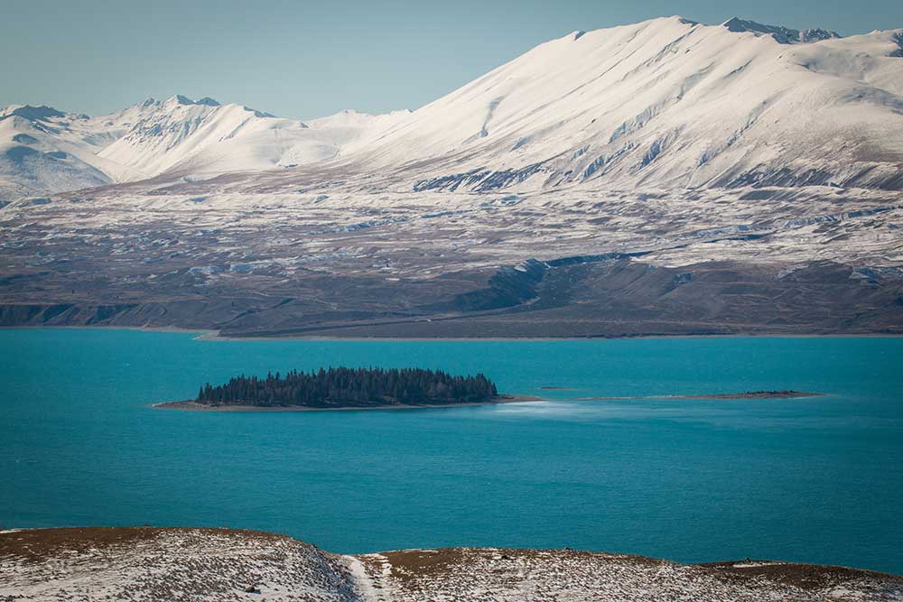
Although Tekapo is one of those blink-and-you-miss-it small towns, the scenery is out of this world. A short hour’s drive from Mt Cook, you’ll travel along the shores of Lake Pukaki then through a network of canals to arrive at the foot of – literally – the most beautiful lake you have ever seen. Both Lake Pukaki and Lake Tekapo get their amazing turquoise color from ‘rock-flour,’ a very fine sediment ground by glaciers and suspended in water. Tekapo is set in the middle of the Mackenzie Basin – named for a 1800’s Scottish sheep thief Jock Mackenzie – and is also part of the same UNESCO Aoraki Dark Sky reserve as Mount Cook, so it to is an ideal spot for stargazing.
One of the most well known – and most photographed – landmarks is the Church of the Good Shepherd. This iconic stone building was built in 1935 and utilises part of the wood from the demolished Tekapo bridge. Still used as a place of worship, it has to be one of the best places on earth to attend a church service! Just know you’ll never have the place to yourself, day or night.
Nearby you’ll come across the statue of a Bronze Sheepdog – a symbol of the contribution these working animals have made to the district. West of Lake tekapo is Mt John, and it’s here you will find the Canterbury University Observatory. You can choose to take the Mt John Walkway to the summit, a three hour loop track with panoramic views of Lake Pukaki, Tekapo and the Southern Alps, but if you’re all walked out after your time at Mount Cook, I totally understand! Drive to the summit instead for the same gratification. While you’re in the car, continue a little further towards Lake Alexandrinaa wildlife reserve home to many birds (yes, I’m on about the birds again). No motorised craft are allowed on the water, and often large brown and rainbow trout can be seen below the surface.
ChristchurchThe Beginning of the End
Your final leg from Tekapo to Christchurch can be done in a leisurely three hours, or stretched out to a full day of travelling. I’d recommend the latter, as this route tracks through the heart of the scenic Canterbury Plains. Leaving the glacial lakes you’ll traverse the High Country and begin descending Burkes Pass and it’s here the scenery becomes less mountainous.
Go through Fairlie, and continue about half an hour to reach the quaint rural town of Geraldine. Stop for a breather and get a feel for the rustic kiwi charm this little settlement is known for. When I’m here I like to peruse all the cute stores – there’s even one selling handmade quilts! As you know, I’m a tiny bit obsessed with Alpacas and Geraldine is the perfect place to indulge that obsession. Take an Alpaca walking tour where – get this – you can walk your own Alpaca! Guys! If you’re not as obsessed as me, you can just feed them..or maybe skip this activity if you’re really not that keen (seriously though, they are like giant teddy bears!) Check out the Geraldine Museum for a bit of history on the area or simply sit under one of the many beautiful trees with a coffee.
From Geraldine, the most direct route to Christchurch is along State Highway 1 through Ashburton. However, I definitely recommend first taking detour through Peel Forest Scenic Reserve to fully make the most of the Canterbury region. You’ll come to Peel Forest first, about thirty minutes further. Stop here and take one of several hikes through the ancient forest. Rata and Emily falls are both good easy ones, but if you can spare the time (and have the stamina) Climb Mt Peel for spectacular views. This one isn’t for the faint hearted though, and is a good four hours of challenging terrain.
Leaving Peel Forest, backtrack to the main road where you’ll head towards Ashburton, also known as Hakatere in Māori. As the main service centre for the surrounding farming districts, Ashburton sits between the Rakaia and Rangitata rivers. In the 1800’s when European settlers first arrived the land was dry and barren. Extensive irrigation using the rivers has transformed the area into a fertile and productive rural hub. Both trout and Salmon are abundant in the area, so if you’re into fishing – this is place!
Ashburton has a rather industrial feel, but the mix of old buildings and beautiful scenery make it rather special. Extensive Scenes from Lord of The Rings were filmed near here, so for fantasy fans take a trip down Hakatere Potts Road for many recognisable locations. For the truly avid, I recommend doing a tour to the summit of Mt Somers – also known as Edoras from LOTR.
One of Ashburton’s little known gems are its Lakes. A short drive along Hakatere Heron road, you’ll come across nine different pools of varying size. These lakes are a beautiful place to walk, swim or just a peaceful place to relax by and enjoy the scenery. In the winter most freeze solid and are usually accompanied by a hoar frost making for a pretty spectacular picture! I recommend visit the Māori Lakes and Heron Lake if you don’t have time for them all.
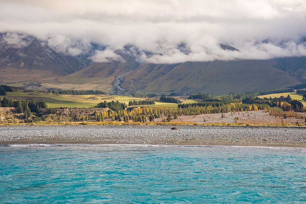
Leaving Ashburton, the final stopping point before reaching Christchurch is the Rakaia Gorge. Located on the seriously picturesque Rakaia River get out here to do the Rakaia Gorge Walkway. Around 3-4 hours of easy walking, you can choose to do the whole track or turn back when you’ve had enough. The walkway follows the rim of the gorge, and the river, then descends through a gully to the site of the abandoned Snowden Coal mines. An interesting historical spot, you can still see the entrances to several of the mines as well as the remains of disused extraction equipment.
Another 30 minutes on you’ll leave the beautiful braided river and sweeping empty plains behind before crossing into the outskirts of Christchurch City – back to where your trip began.