As hiking in New Zealand gets more and more popular, trampers are turning away from the basic day hikes and instead are looking more and more to challenging day and multi-day hikes available around the country.
While tackling these tramps these can be a truly unforgettable experience, they are not be underestimated; many of them classified as advanced or expert routes that require experience and preparation.
If you’re planning on getting into the alpine zone in New Zealand, you’re in luck! The Mountain Safety Council here has created an amazing video series on Youtube to help you plan and prepare to tackle some of the most popular alpine hikes in New Zealand, so you can safely get out there and explore this country to the fullest.
Here are nine of the best alpine hikes in New Zealand to inspire you on your next adventure. Have fun but above all, be prepared and make it home safely!
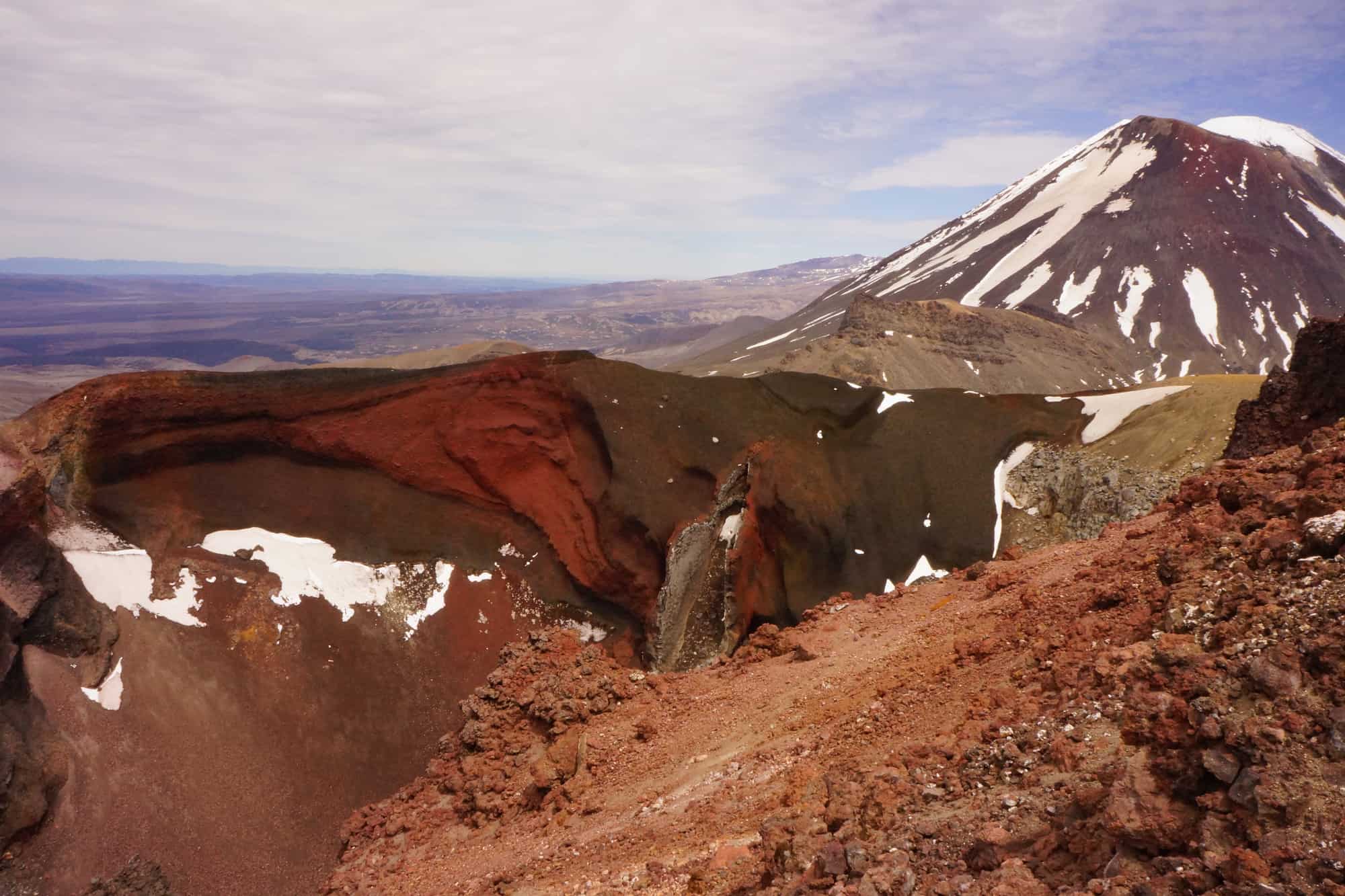
1. The Tongariro Alpine Crossing
Lord of the Rings fans are sure to recognize this iconic spot and the famous Ngauruhoe aka Mount Doom (though it’s no longer recommended to climb it). This area is a Dual World heritage site which recognizes the natural environment and the cultural and spiritual significance this land has to local Māori.
The Scoop:
Considered one of the most challenging day hikes in the country, the Tongariro Alpine Crossing travels 19.4 km through an active volcano. Extreme weather, terrain, and distance have resulted in this track having the highest number of search and rescue in New Zealand.
The logistics:
The crossing is not a loop so you will need to organize transportation to from the track and as always with New Zealand’s high seasons (book in advance). And since last year you can no longer park at the car park on either end for long enough to complete the track.
From the carpark, the track climbs up the Devil’s Staircase, one of the most strenuous parts of the track where you’ll climb 300 meters over 2km. After you complete South Crater, you’ll traverse up Red Crater which is an exposed rocky track. DOC has installed chains to help you up the hardest parts.
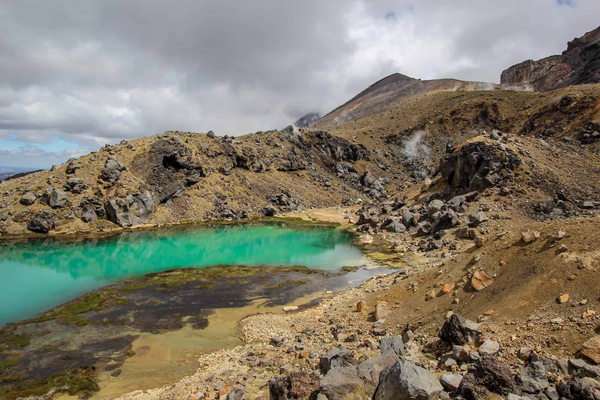
The descent down red Crater is the most common place for injuries and search and rescue calls. The descent is steep and the scree is slippery. Soon you’ll arrive at Emerald Lakes which are beautiful but sacred to local Māori so do not touch the water, build cairns or throw rocks.
From there, you cross the central crater to get to Blue Lake which is also sacred (no touching!) Beyond the lake, you’ll start the descent which is fairly easy and increasingly less exposed to weather but this section is deceivingly long so take care.
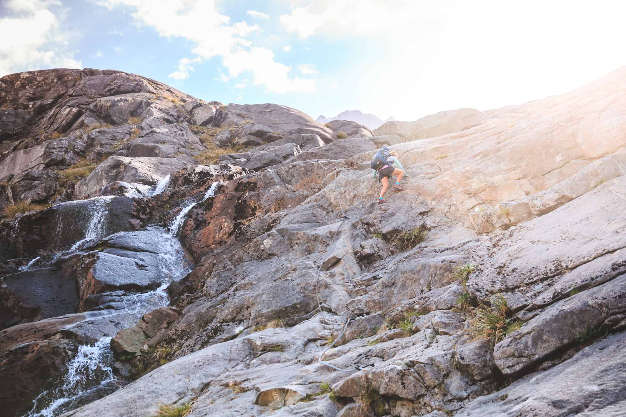
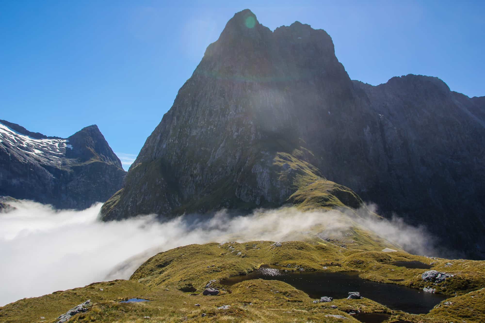
2. Gertrude Saddle
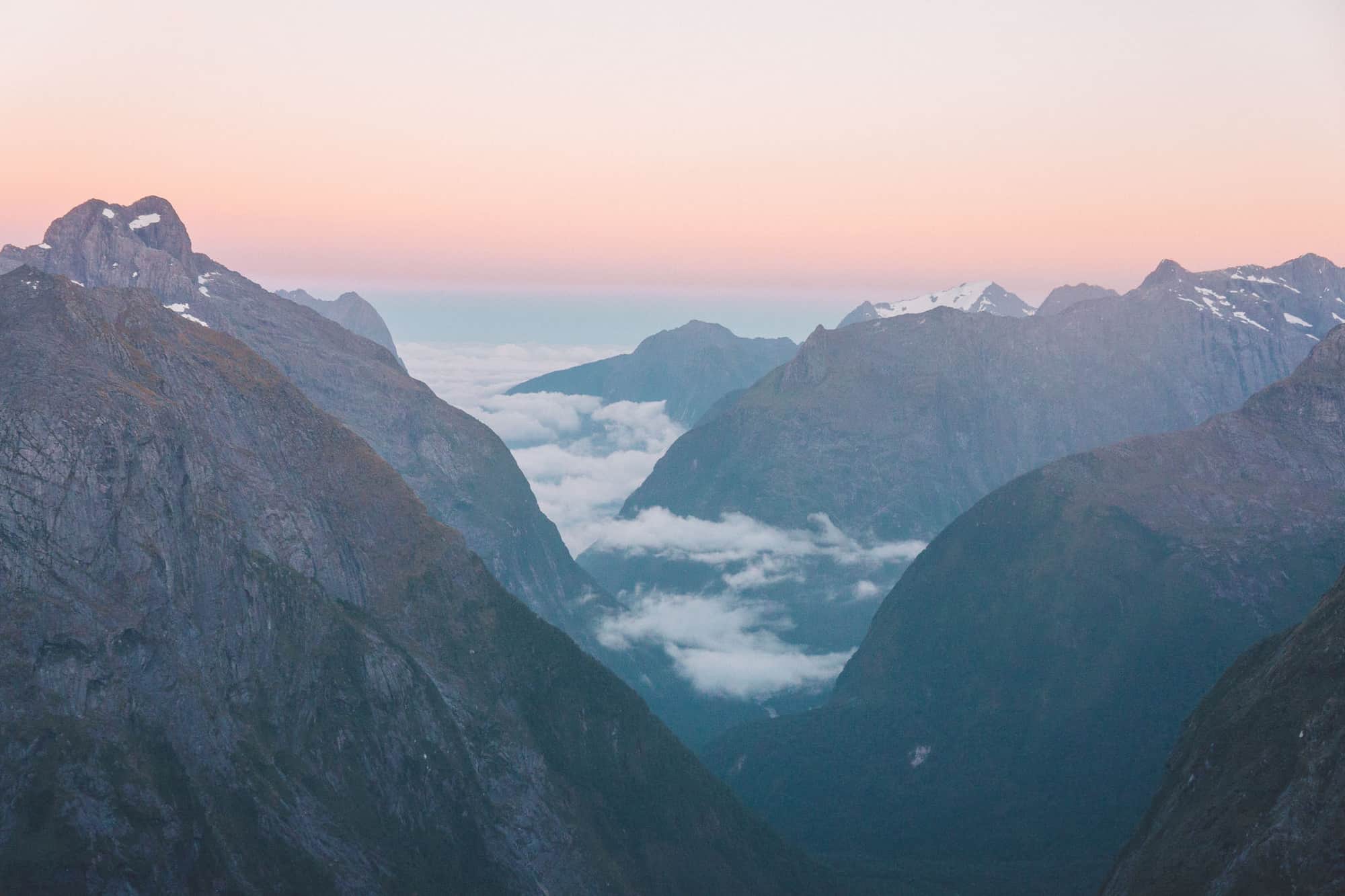
Those looking for amazing views of Fiordland without shelling out lots of money for the Milford Great Walk will be tempted by the stunning views from Gertrude Saddle, a day hike that brings you up high on the saddle of the Gertrude Valley looking down into Milford. The view is epic (when there’s visibility) for a day hike but the risks are there.
The scoop:
One of the most challenging tramps in Fiordland is the Gertrude Saddle Route. Deceptively short, it’s 7km tramp and 6 hours return for those who take their time, but there are several hazards that have caused plenty of rescues and deaths for those who’ve tackled it.
The route crosses multiple avalanche chutes making it impassable in winter.
This route should not be attempted in wet or snowy conditions because the rock slabs you have to traverse are super slippery and nothing will stop a fall. There have been multiple deaths on this hike.
The logistics:
The track starts in an alpine meadow with a well-marked route on the road to Milford Sound. At the head of the valley, you’ll start up the saddle. The terrain is mostly rock and scree and gets steep fast.
After a bit of climbing, you’ll reach the waterfall area, one of the most hazardous parts of the trail. Follow the orange markers and cross only where they lead you. You’ll reach a scree slope that will eventually give way to granite slabs which can be extremely slippery. From there you will reach Black Lake, a good sign you’re close to the saddle.
Traverse around the lake and up more boulders to reach the saddle. From here, you’ll be rewarded with some of the most spectacular views of Fiordland and Milford Sound but take care, the saddle is a 700-meter sheer drop from the valley floor, so take in the views but keep your distance from the edge.
This is not one for those who are afraid of heights!
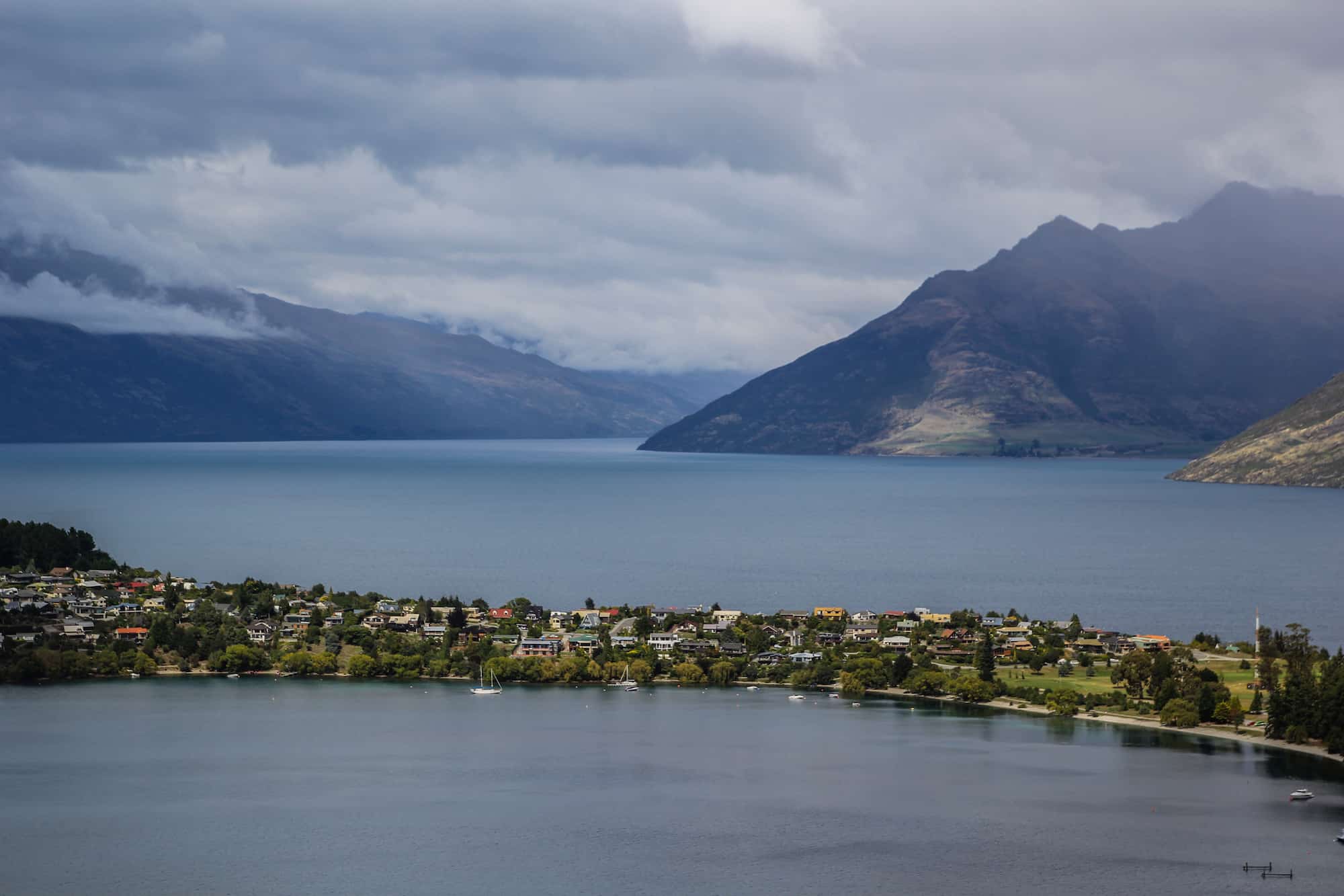
3. The Ben Lomond Summit
Trampers visiting Queenstown will be sure to seek out Ben Lomond, one of the most accessible hikes in the area, and for good reason: the hike is close to town, is well marked and provides unparalleled views of Queenstown and Lake Wakatipu.
The scoop:
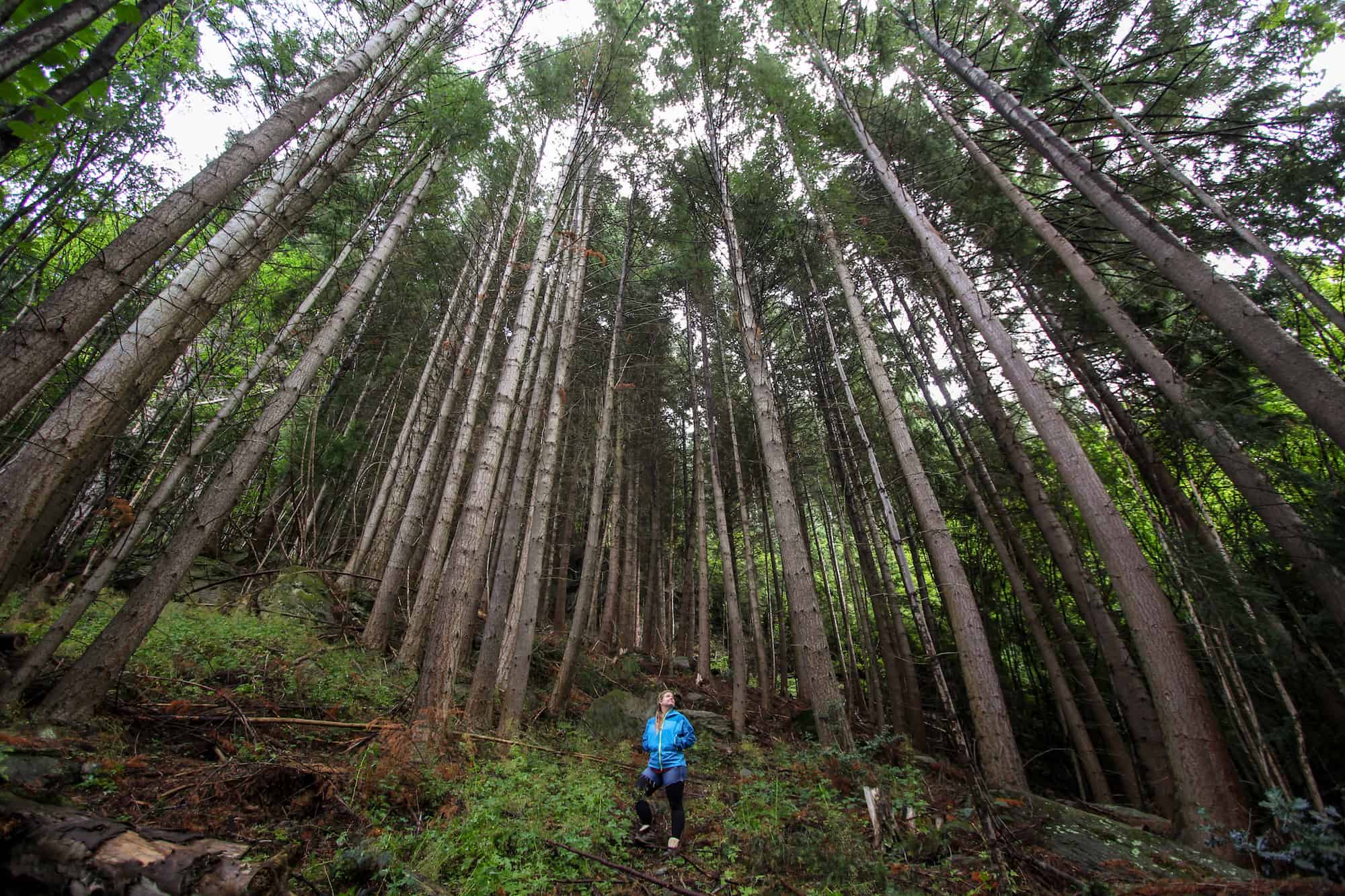
You can start the track one of two ways. The most popular is at the bottom of the gondola. You can either pay for the gondola up or you can walk the route through the forest up to save money. The other route starts at the bottom of Skyline Access Road.
The logistics:
Soon you’ll reach the Ben Lomond saddle which will leave you exposed to high winds and weather from the west. If you want to continue up to the summit, take a left at when the road splits. Going right will take you to Arthur’s Point (this junction is well marked). The route up to the summit is not well marked and if snow is present, you will need crampons, avalanche skills, and equipment to get you there.
Once at the top, it might look like you can head down the western ridge, but this is a track that has only been created by people heading the wrong way and taking this route will only lead to steep bluffs.
This is a spot of frequent search and rescue calls. The only way down is to go back the way you came.
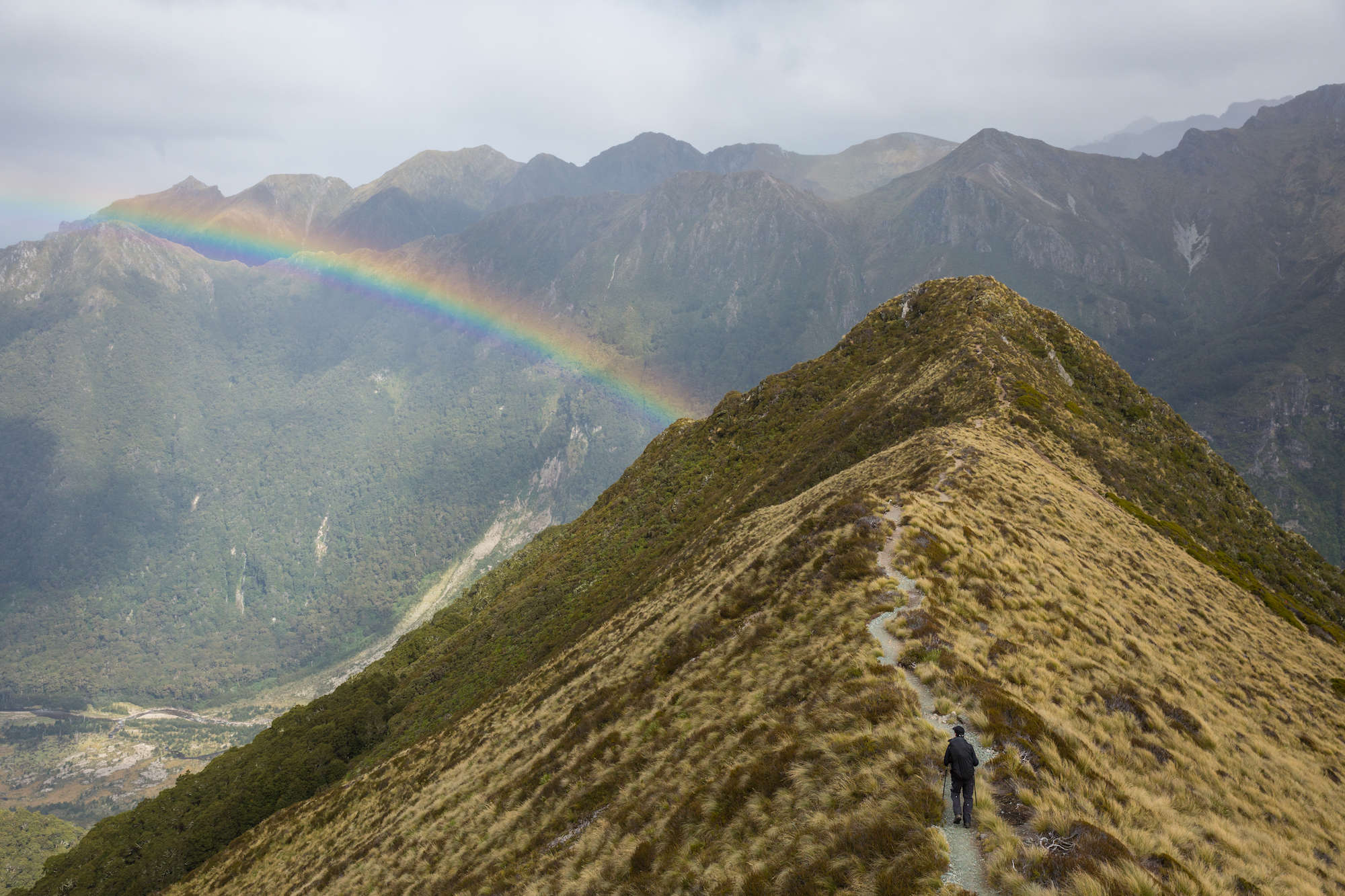
4. The Kepler Track
One of New Zealand’s Great Walks, the Kepler Track leads trampers high above the glacially carved valleys of Fiordland. Because of its popularity, bookings are essential and the track is often booked out months in advance.
The scoop:
The alpine section of this track runs for about 14km and gives you unbelievable views of Fiordland and the neighboring mountain regions.
The best time to attempt this hike is October – April. Winter months receive lots of snow and make the alpine section of this hike very difficult and treacherous, and there have been avalanche deaths caused by those who’ve ignored warnings and were unprepared.
The logistics:
The track is a loop and starts from the Kepler Track carpark. You walk a relatively flat track for 1.5 hours before reaching Brod Bay Campsite. This is where the climbing begins. You’ll climb 8.2 km up to Luxmore Hut, which takes approximately 3-4 hours.
Once you reach the bushline, you’ll be exposed to an open alpine environment. This section is known to be windy so make sure you have enough layers to get to Luxmore Hut. It’s not unknown to be so windy it rips pack covers off and trampers have to use their hands and knees.
Your second day consists of a 5-6 hour tramp along the al;ine ridgeline to Iris Burn Hut which will leave you exposed to any and all weather. There are a few shelters but no exit routes so before leaving Luxmore Hut, talk to the hut warden to ensure conditions are good.
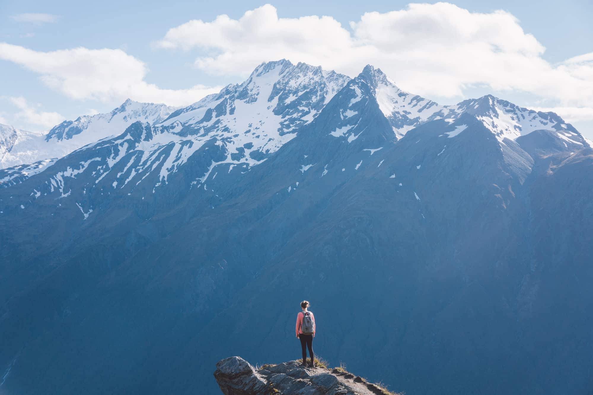
5. The Cascade Saddle
The Southern Lakes area has been sculpted over time by colossal glaciers which have created some of the most beautiful terrains in all of New Zealand. It’s no secret that the Mount Aspiring region holds some of the most beautiful gems in the area, one of which has gained significant recognition in the past few years: the Cascade Saddle.
The scoop:
This 8-10 hour 17 km route is a beautiful alpine crossing that connects the West Matukituki Valley with the Dart Valley and is part of a longer, multi-day tramp. DOC recommends starting the hike only from the stepper Matukituki side as it’s much safer to climb up than back down.
This is a challenging and technical hike and numerous fatalities have occurred here so trampers attempting this hike should have a high level of experience and skill and only attempt it in dry, fine weather.
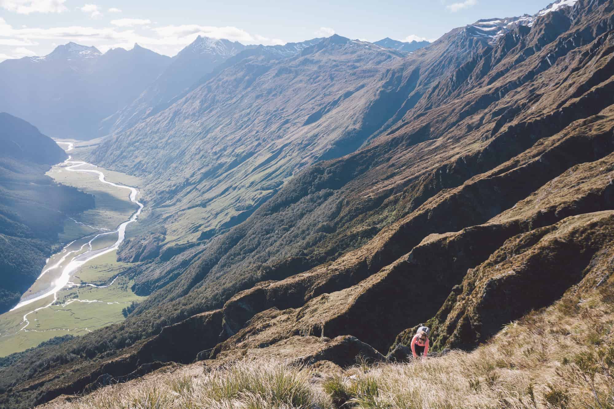
The logistics:
Once out of the bush, there will be no shelter for the next six to nine hours and the climbing can be difficult. You’ll need to use your hands to climb up a lot of the sections and the terrain can be slippery and fatal in wet conditions. The climb zigzags above the bluffs which is the most dangerous part of the track. There is essentially no room for error. A slip here will be fatal, so you need to be extremely cautious.
Roughly 4 hours after leaving Mt. Aspiring Hut, you’ll reach the high point of your journey. You will still have six hours of challenging tramping to go including river crossings. The views as you pass the Dart Glacier and looking out to Mt. Aspiring, the highest peak in the region are so incredible.
Dart Hut marks the end of the Cascade Saddle Route but keep in mind you’ll still have 1-2 days of tramping before you reach the road end.
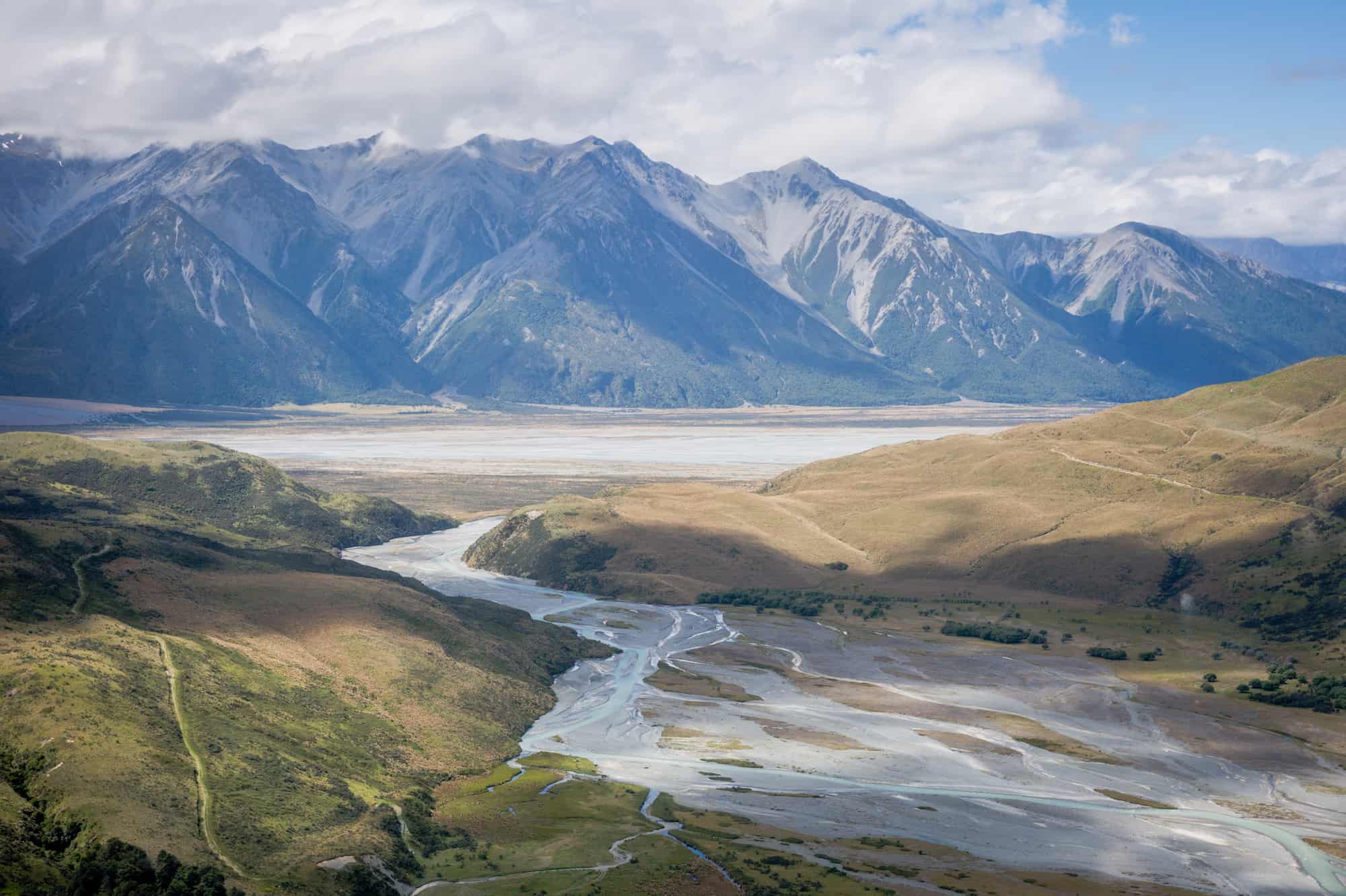
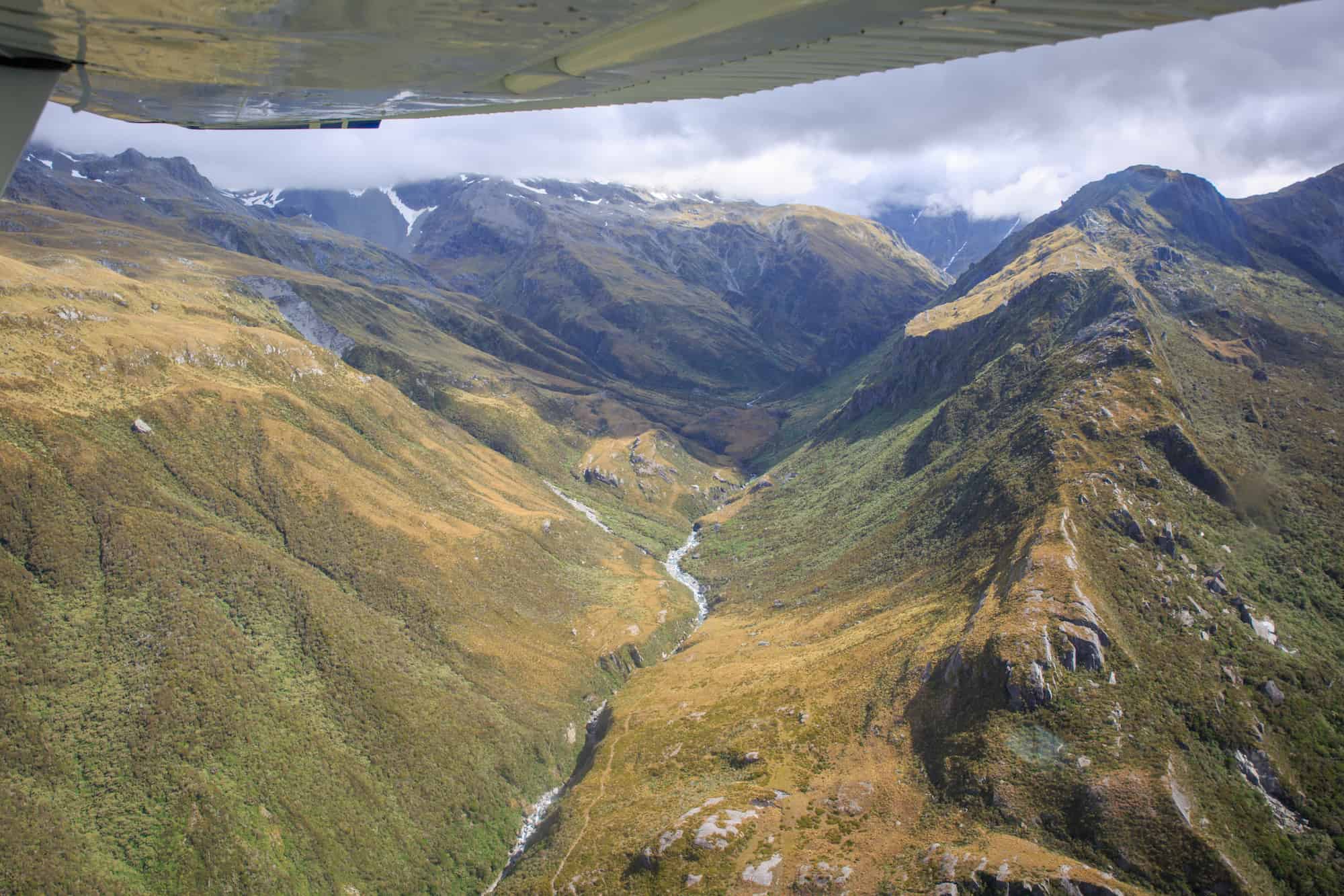
6. The Waiau Pass
The Waiau Pass has become a popular hike for those looking for a challenging alpine hike. A beautiful pass that links the Lewis Pass with Nelson Lakes National Park, even the access to the base of Waiau Pass is no easy feat.
This track is often accessed via Travers-Saddle, Lake Rotoroa or the Lewis Pass side, all which take 4-5 days so to complete the entire tramp, you’ll need to allow 8-10 days for a full trip.
The scoop
Crossing the pass takes 9-12 hours over 12-15 km and requires a high level of route finding skills and abilities. You’ll need an ice ax and crampons (and the skills to use them) in case snow is present on the pass. A personal locator beacon is also strongly recommended in this very remote part of New Zealand.
Walking the pass north to south has you beginning at the Blue Lake Hut. The lake has some of the most pristine water in the world. Because it is a sacred Māori site, please do not swim, bathe or wash clothes/dishes in this lake.
The logistics:
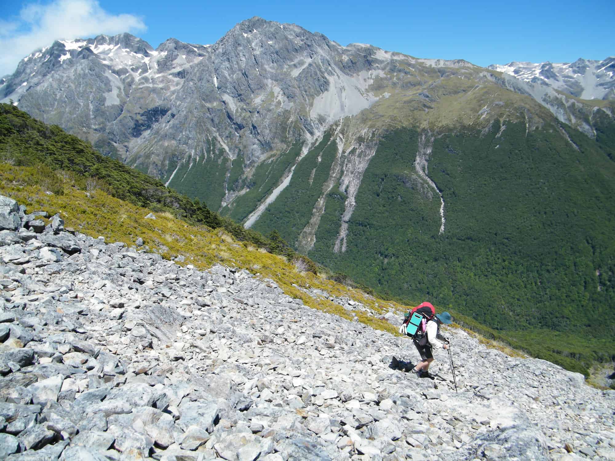
The track to Blue Lake Hut is relatively easy. You’ll quickly start a climb up to a Lake Constance Plateau. The start of the Waiau Pass is steep and tricky.
The tussocks give way to a scree slope and navigating can be challenging. A small plateau halfway up the climb will present a false summit directly above you. The correct track continues to the right and around the prominent peak. You’ll soon reach the summit of the path which will be windy and cold.
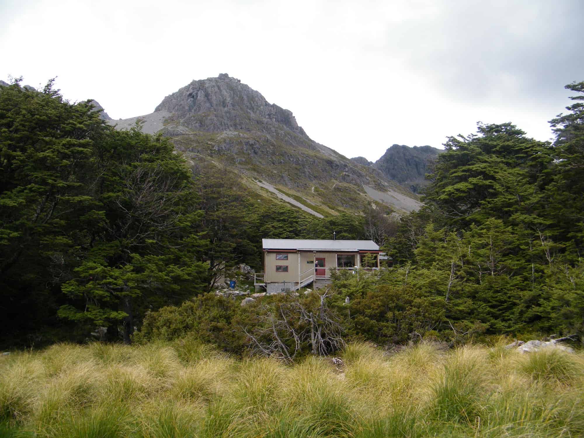
Caroline Creek Bivvy will be the first shelter you’ll encounter but this hut only has two beds so a tent may be necessary.
7. The Poukirikiri/Travers Saddle
Experience stunning beech forests, fields of native tussocks blowing in the wind and 2000 meter high mountains in the heart of the mountains of Nelson Lakes National Park and one of New Zealand’s greatest and wildest tramps.
The scoop:
Travers Saddle is a challenging section of track that links Upper Travers Hut to West Sabine Hut as a part of the greater 80 km Travers-Sabine Circuit. Reaching the Travers saddle means you’ll already be a few days into your journey.
A personal locator beacon is recommended due to the extremely remote nature of this hike.
Images by Tony Marsh
The logistics:
The crossing of the saddle starts at Upper Travers Hut. You’ll start by crossing a relatively easy alpine field. At the end of the valley, you’ll take a right turn and head up the ascent. After navigating a few boulder fields, you’ll find yourself at the top of the saddle.
The descent begins with a scramble down a short, steep section of the route. It’s easy to take a wrong turn here. Although it might appear the route continues straight down, it actually bends to the right so make sure you’re following the markers.
The Southwest Face of Mt. Travers is dominated by avalanche hazards. It shouldn’t be an issue in summer but in the right conditions, it could still be dangerous. From this point, you’ll be out of the alpine environment and will follow the valley down to West Sabine Hut, which marks the end of the alpine crossing.
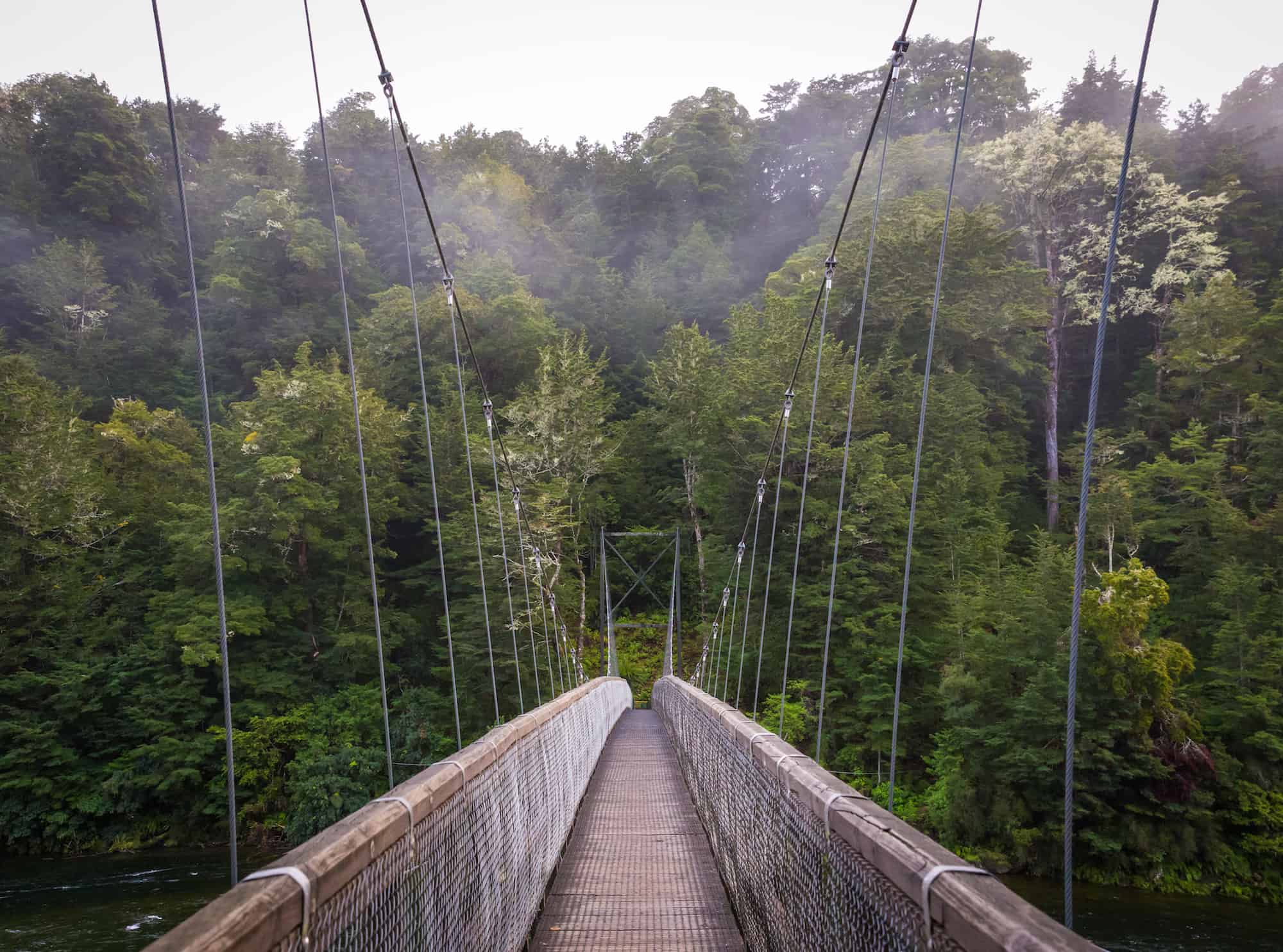
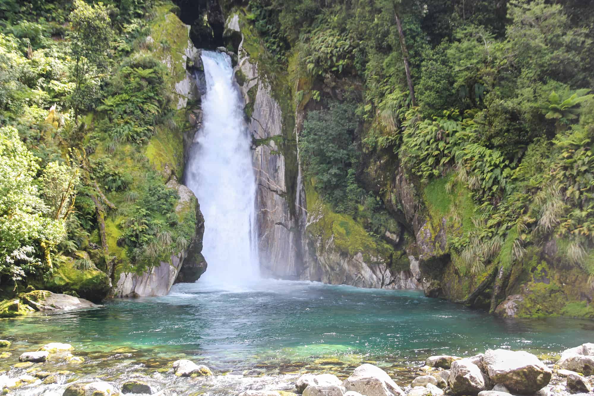
8. The Milford Track
The Milford Track is quite possibly New Zealand’s most famous hike, a multi-day Great Walk that is incredibly popular and often tops the bucketlist of many.
The bookings for the huts on the Milford Track are often made a year in advance so be sure to check with DOC if you’re interested in attempting this hike but also there are different ways to make it happen, and there are private guided options as well. Also it’s not unknown to be able to secure a last minute spot from cancelations.
The scoop:
This 53km track takes you through the guts of Fiordland over the course of four days. This track requires a steep climb up and over MacKinnon Pass and should only be attempted between November – April when all facilities are open and the track is safe.
Many of the bridges are removed out of season and the track traverses complex avalanche terrain in winter, and there have been fatalities on the Milford Track, and it’s not to be taken lightly. The mountains here are unforgiving.
The logistics:
You start with a bush climb will last for 350 meters before giving way to open alpine terrain. The good news? Fewer sandflies. The bad news? the alpine environment makes you more prone to high winds and alpine weather. You continue to zig-zag up but the track will be composed of big rocks which will require sure footing.
At the top of the pass, you’ll either get a great view down the Arthur Valley or be absolutely battered by bad weather. Both sides of the pass are incredibly steep with some spots reaching a 500m sheer drop to the valley floor. From the saddle, you’ll start your 1000m descent beginning with a series of zig-zags which are notoriously windy. The second section takes you around a cliff bend. The track is narrow but has handrails to help steady yourself. The third section takes you into the bush which is sheltered but has rocky footing.
This whole descent sits in a highly avalanche-prone area. Avalanche conditions are monitored regularly by DOC so if avalanche risk is high, DOC will open up an emergency track to help you descend to the shelter directly. This track is very basic and should only be used if the main track is closed.
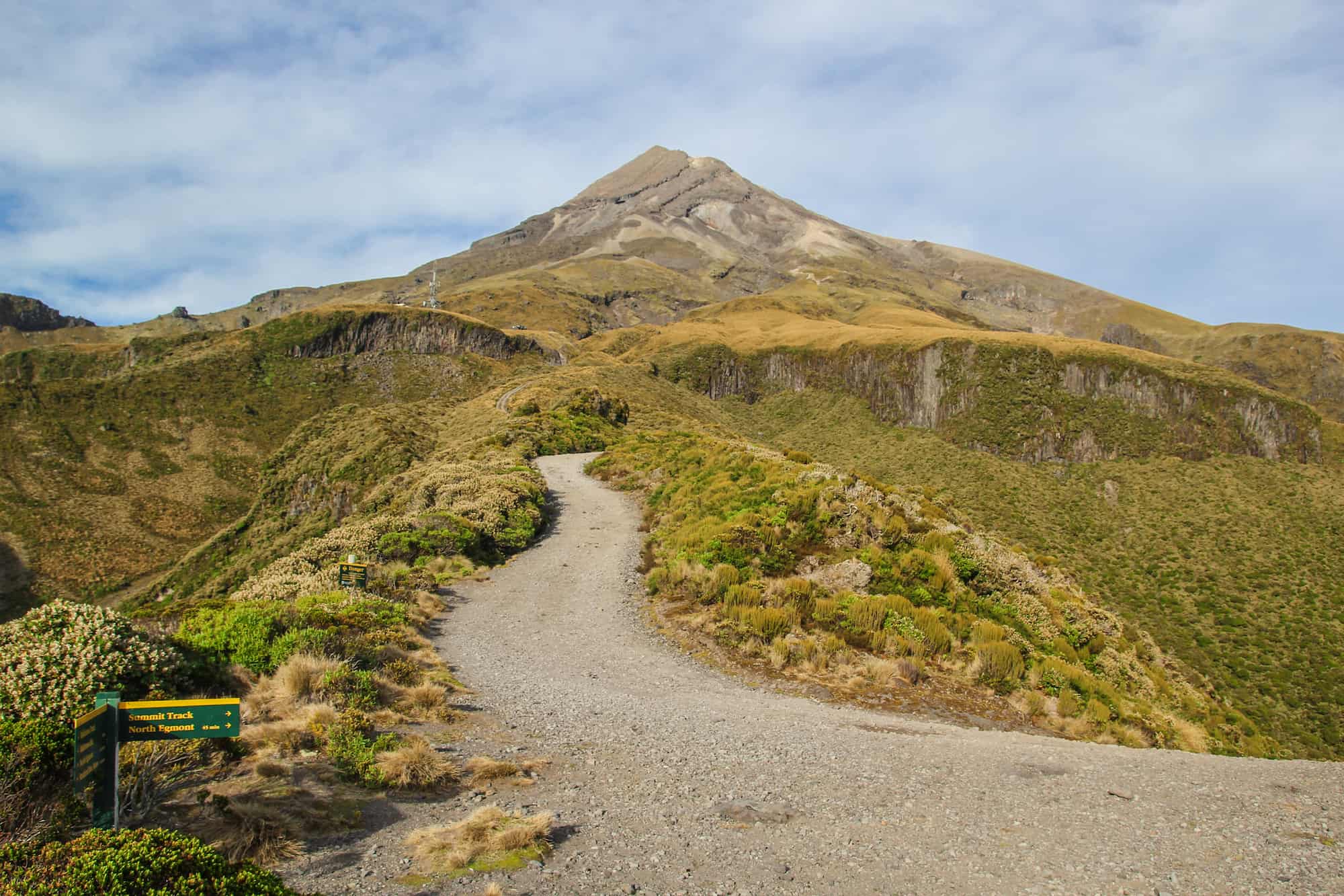
9. The Mount Taranaki Summit
Mount Taranaki is probably one of the most perfect conical volcanoes in the world, sleeping until it blows it’s top again. Sitting pretty at 2,518 meters tall, it stands out among the flat plains of the surrounding countryside all the way to the sea.
This now dormant volcano lies quietly above the west coast of New Zealand’s North Island and is one of the most symmetrical volcano cones in the world. As one of the only prominent features in west coast skyline, this peak draws hundreds of trampers every year to its summit.
The scoop:
The Mount Taranaki Summit should only be attempted in good weather by experienced trampers with proper equipment. Deceptively accessible, it’s New Zealand’s deadliest mountain, claiming more lives even than Mt. Cook, the highest peak in the country.
Often underestimated, the weather is fast and unpredictable here, leaving many unprepared trampers in the lurch.
The logistics
The massive day hike will start from the Egmont car park and follows a dirt road that is easy going and sheltered for a while; this paved road is brutal on the knees on the long descent. You’ll reach a shelter and then head into the gully on a narrow but defined track. This track disappears quickly and you’ll need to be able to navigate yourself through a boulder field that requires a bit of rock scrambling.
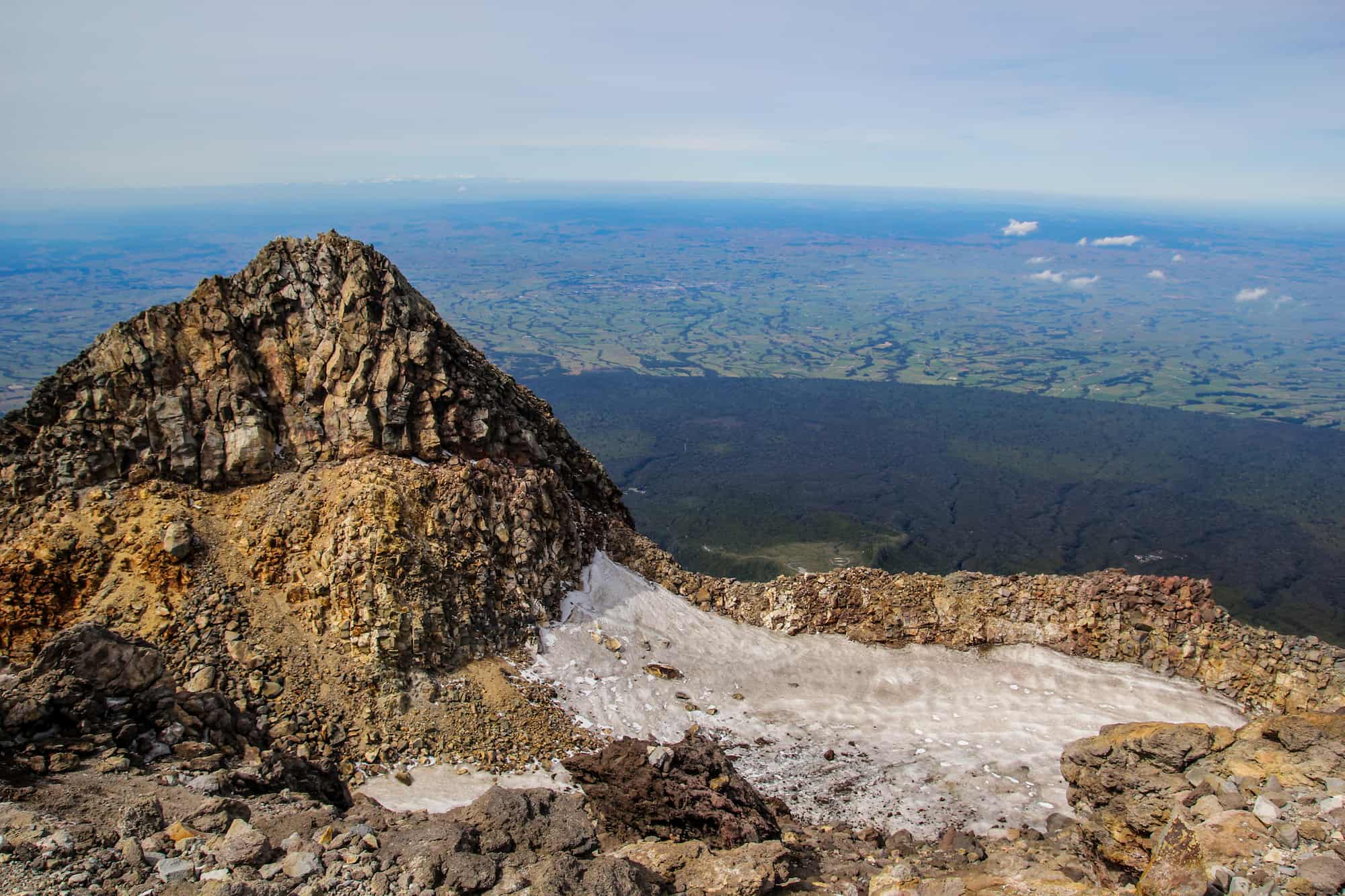
The upper section of the gully has a set of stairs that will take you up and out onto the ridgeline. You’ll begin up a long scree slope which basically feels like walking in quicksand. After 1-2 hours climbing up the scree, the terrain changes to large steep rocks, a section known as The Lizard. You still have 1-2.5 hours of climbing left before the summit.
You’ll walk along a long skinny and exposed ridge before dropping into the crater. You’ll have one last rock slope to climb. After that, congrats! You’ve reached the summit. Enjoy the views but keep in mind this mountain has deep cultural significance to Taranaki Māori, so please don’t stand on the summit stone and be respectful of this place.
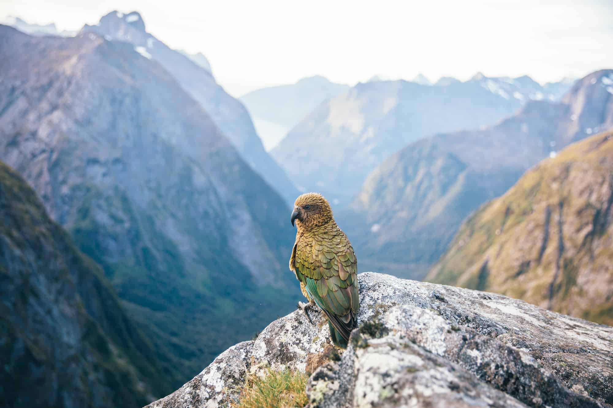
These hikes look amazing, I’m adding them all to the list now. Great kea pic too!
cheers
that ben Lomond looks identical to ben Lomond in Scotland… no doubt where it got its name from
I reckon!
After reading this blog I really want to travel all of these places once in my life. Thank you for sharing your experience with us. Keep sharing, keep traveling.
cheers
Hi Liz!
Thanks to sharing nice blog with us for giving the information about your experience of the 9 place hikes in New Zealand and also the sharing the tackle them to safe .
thanks!